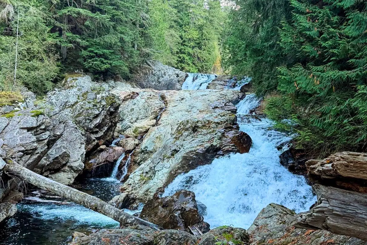
Olallie State Park sits just outside North Bend and is best known for the popular Twin Falls Trail. Still, the forests along the South Fork Snoqualmie River offer much more than most people think.
Here, you can discover roaring waterfalls, mossy old-growth forests, peaceful river views, specialized areas for gravel biking and rock climbing that leave the walking paths quiet, and even traces of one of Washington’s earliest pioneer routes across the Cascades, all spread out over more than 2,000 acres.
Even though Olallie is right next to I-90 and less than an hour from Seattle, some areas still feel wild and untouched. Most visitors just hike Twin Falls and leave, but if you have time, it’s worth exploring more.
I’m a big fan of our state parks and have set out to visit every one in Washington. After spending time at Olallie, I figured out how to make the most of it.
To save you from the usual pre-trip planning overwhelm, I’ve mapped out what you can expect… including driving exits, how to navigate the different trailheads without getting lost, where to find the absolute quietest sensory spots, and the deep local history that makes this landscape so magical.
Olallie State Park Quick Take
- Location: Near North Bend, Washington
(Exit 34 & Exit 38 off I-90) - Distance from Seattle: Approximately 40 miles, depending on your destination
- Park Size: 2,300+ acres
- Best Known For: Twin FallsTrail
- Also Great For: Slow nature pacing, old-growth forest bathing, river photography, bird watching, and tracking down iconic Twin Peaks filming spots.
- Parking Pass: Washington Discover Pass required. (Tip: Pass options vary by trailhead, so buying an annual or day pass ahead of time eliminates any arrival guesswork!)
- Dogs: Allowed on a leash! Please be a responsible pet owner.
- Camping: No (Day-use only)
- Park Hours: 6:30 a.m. to dusk
- Current Trail Update: As of late 2026, always check the Washington State Parks website for current conditions, as heavy winter storms can cause temporary closures or trail washouts along the steep river canyon.
Where Is Olallie State Park?
Before you go, know that Olallie isn’t like most state parks. There’s no big main entrance, no central ranger station, and no huge park map to greet you.
Instead, the park stretches along the South Fork Snoqualmie River, with trails that connect like a big web. If you just type “Olallie State Park” into your GPS, it will automatically send you to the popular western end at Exit 34. While beautiful, this main lot is often the busiest and most crowded spot in the park.
To visit other parts of the park, like Weeks Falls or the old rail trails, you’ll need to navigate a mix of highway exits and short, well-maintained gravel access roads. The main areas of the park are:
- Twin Falls (Exit 34)
- Homestead Valley & Deception Crags (Exit 38)
- Mount Washington Trails (Exit 38)
- South Fork Picnic Area & Weeks Falls (Exit 38)
You probably won’t see all these spots in one visit, and that’s fine. This park is built for slow, mindful pacing. You can give yourself full permission to choose one pocket today, soak in the quiet, and return to find a new pocket next time.
Driving Times from Major Regional Hubs
- Driving from Bellevue
- Distance: 30 miles east
- Drive Time: 30 to 35 minutes
- The Route: Hop directly onto I-90 East right from downtown Bellevue and follow it through the scenic Snoqualmie Valley past North Bend to Exit 38 (State Fire Training Center)
- Driving from Seattle
- Distance: 38 miles east
- Drive Time: 40 to 45 minutes
- The Route: Head straight out of the city on I-90 East past Bellevue and Issaquah, taking Exit 38 (State Fire Training Center) for a quick, accessible I-90 corridor day trip.
- Driving from Tacoma
- Distance: 48 miles northeast
- Drive Time: 50 minutes to 1 hour
- The Route: Take WA-18 East through Federal Way and Covington to completely bypass downtown Seattle congestion, then link up with I-90 East just past Snoqualmie and take Exit 38.
- Driving from Olympia
- Distance: 96 miles northeast
- Drive Time: 1 hour and 35 minutes to 1 hour and 50 minutes
- The Route: Take I-5 North out of Olympia, connect to WA-18 East in Federal Way, and merge onto I-90 East toward Snoqualmie Pass until you reach Exit 38. This scenic drive is perfect for a full day exploring Western Washington’s old-growth forests.
Olallie State Park Entrances, Exits & Trailhead Directions
Finding your way around Olallie State Park can be a bit confusing, especially with its various entrances and trailheads. Here’s a simple guide to navigating the park from west to east to help you avoid some of the confusion I experienced during my visit.
1. Exit 34: Twin Falls Main Trailhead (The Classic Entrance)
- Best for: The classic Twin Falls hike, river views, and waterfall photography.
- The Route: Take Exit 34 and turn south onto 468th Ave SE. Pass the local truck stop for about half a mile, turn left onto SE 159th St, and follow it to the paved parking lot.
- Insider Tip: While there is a designated parking area, it gets incredibly packed during the spring and summer, especially on weekends… with a long line of cars overflow-parked along the roadway. If you visit on a weekday or during the off-season, you might actually snag a spot inside the lot.
2. Exit 38: The Homestead Valley Private Property Trap
Heads up: If you take Exit 38 and turn left (north), the road quickly ends at large fenced-off areas with Private Property and No Trespassing signs. This is a secure utility area for the Seattle Watershed and Seattle City Light. Don’t waste your time here… just turn around and go back under the freeway.
3. Exit 38: Homestead Valley Trailhead (The “Backdoor” Connector)
- The Route: From Exit 38, head right (south) under the freeway onto SE Homestead Valley Road. Keep driving until you see a small brown sign that says Olallie State Park. There you will find a modest gravel lot with a restroom, a pay station, and a large wooden information board.
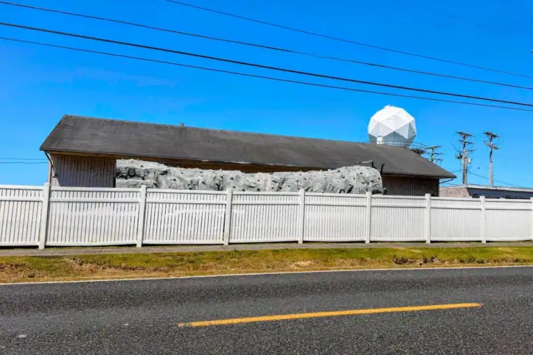
- What it’s like: This is a quiet, simple parking area mostly used by climbers.
- Best for: Connecting to the Palouse-to-Cascades State Park Trail, hiking, biking, and accessing the popular Deception Crags sport-climbing areas.
- Hidden path: From this lot, a steep, narrow gravel trail leads into the woods. It’s not the easiest climb… my energetic canine companion, Bud, almost had to pull me up!
- Once it levels out, you reach a wide gravel road. This is the historic Palouse to Cascades State Park Trail. Go left for the quieter, upper part of the Twin Falls trails, or right to head toward mountain hikes like Annette Lake.
- A Quick Note on GPS Glitches: If you map your route here, your phone’s GPS or mapping app might warn you that this trail is “permanently closed.
- “Don’t pull a U-turn just yet! A major winter storm caused a severe washout, leading to a legitimate closure. However, thanks to Washington State Parks and local trail advocates, a brand-new, 350-foot temporary bypass trail was officially completed and reopened, fully restoring hiker and biker access. The mapping apps just haven’t caught up to reality yet, so rest assured, the Twin Falls trail washout bypass at the “Backdoor Connector” is fully open and ready for you.
4. Exit 38: South Fork Picnic Area & Weeks Falls
51350 SE Homestead Valley Road, North Bend, WA 98045
- The Route: Instead of going back to the freeway from the Homestead Valley lot, keep heading right (south) down SE Homestead Valley Road. The road gets narrower and winds deeper into the woods until you see the official dark-wood Olallie State Park sign.
- What it’s like: This is the best place in the park to relax and hang out. Green lawns, picnic tables, and charcoal grills are under tall trees, with a dramatic rock face across the road.
- Best for: Picnics, riverside relaxation, a short forest walk, and reaching Weeks Falls.
Twin Falls Trail Guide: Olallie State Park’s Signature Hike
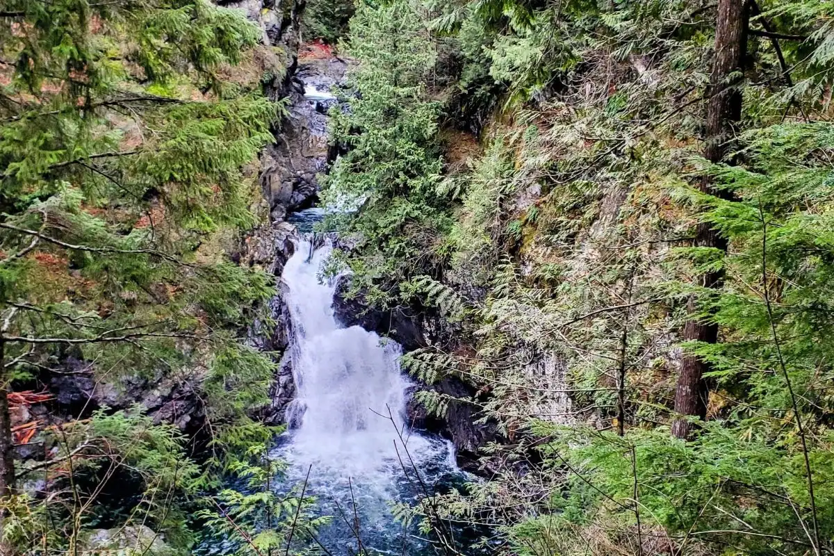
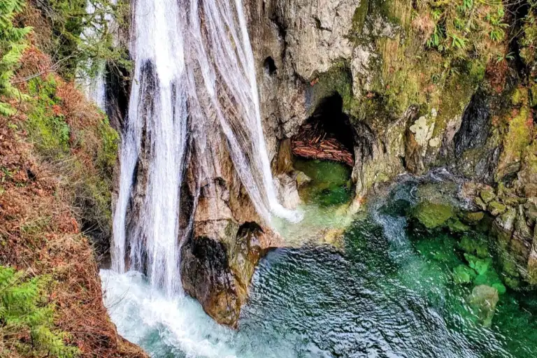
The Twin Falls Trail is easily the most recognizable attraction at Olallie State Park, drawing hikers from all over the Interstate 90 corridor.
The trail follows the South Fork Snoqualmie River through a beautiful forest filled with ferns, moss-covered boulders, and towering trees.
The classic hike is approximately 2.5 miles round trip, depending on which viewpoints you visit, with several hundred feet of elevation gain.
Although it’s a relatively short hike, don’t underestimate it.
There are uphill sections, switchbacks, uneven surfaces, and stairs near the waterfall viewpoints. For readers who crave a high-intensity workout or deep physical focus, these steep wooden steps provide a fantastic full-body challenge that really forces you to tune into your body’s balance.
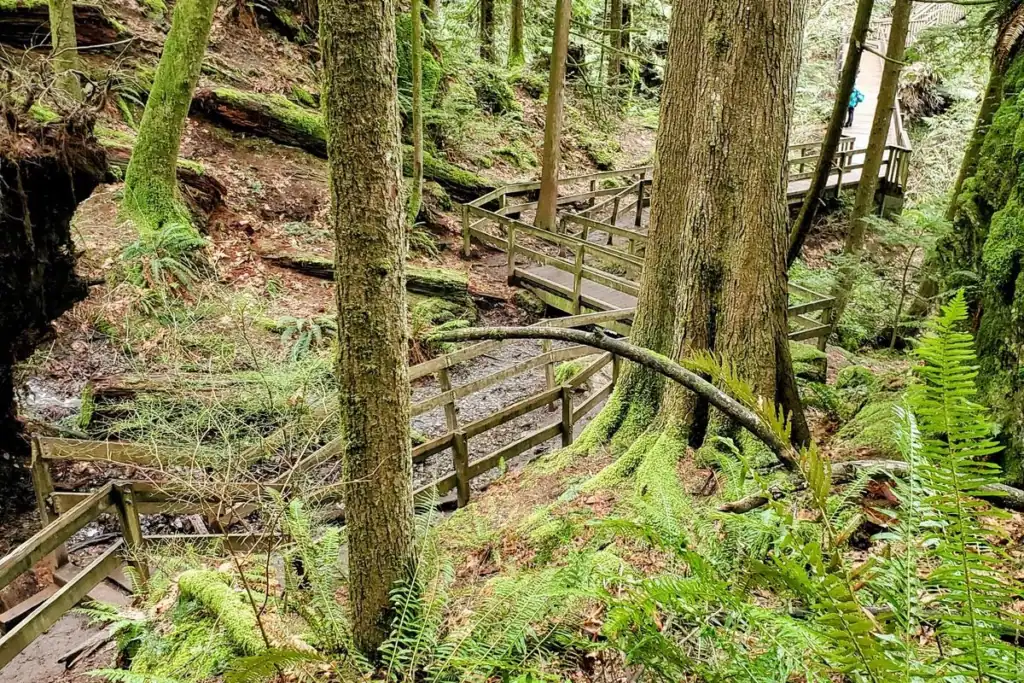
Along the way, the steady sound of the river echoing through the canyon builds anticipation long before you reach the first views of the falls.”
Twin Falls is especially impressive during wetter months, when the river runs high.
It’s a beautiful hike, but it can also be one of the busier trails in the North Bend area.
The main Twin Falls Trailhead has its own parking area, separate from the other entrances to Olallie State Park, so make sure you’re heading to the right trailhead before you set out.
My tip: If you’ve already visited Twin Falls, consider returning to Olallie to explore the quieter South Fork Picnic Area and Weeks Falls instead.
Weeks Falls: A Quieter Corner of Olallie State Park
Twin Falls is the most famous, but don’t miss the quiet beauty of Weeks Falls.
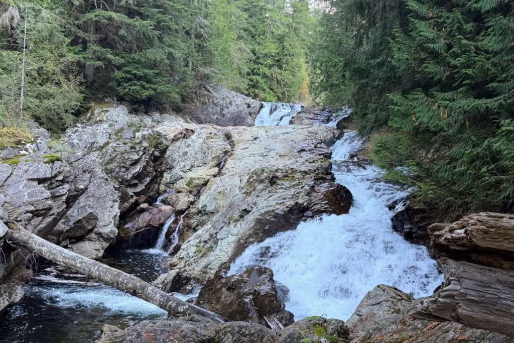
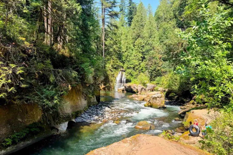
Tucked away in a quieter corner of Olallie State Park, Weeks Falls is a beautiful cascade along the South Fork Snoqualmie River. Unlike the busier Twin Falls area, this section of the park offers a peaceful forest experience.
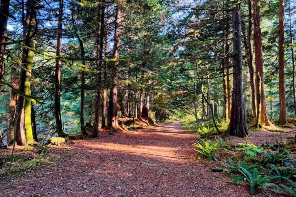
The Weeks Falls Interpretive Trail follows a wide, relatively flat path through towering evergreens, with a smaller woodland trail branching off along the way.
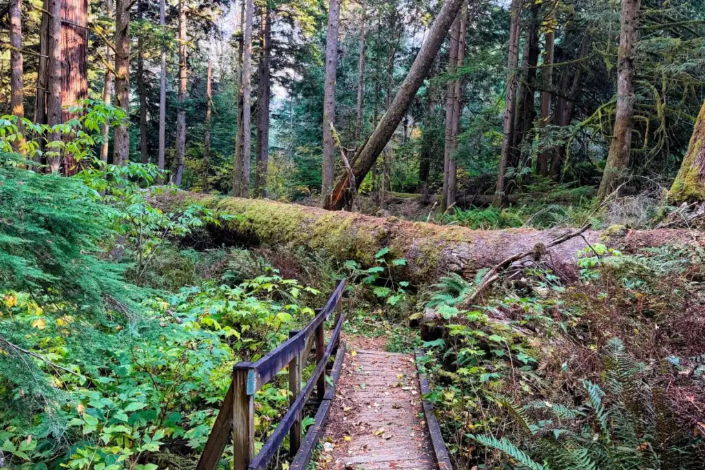
I took that side detour after another visitor told me about a massive old-growth tree that had toppled over deep in the woods… and it was worth it!
There’s also some fascinating Snoqualmie Pass pioneer history along the trail, including remnants of an old wooden road used by early travelers crossing the Cascades.
One of the more unusual features in the area is the Weeks Falls is the hydroelectric facility near the waterfall.
Its concrete rooftop doubles as a viewing platform overlooking the river, and there’s another smaller concrete overlook closer to the falls.
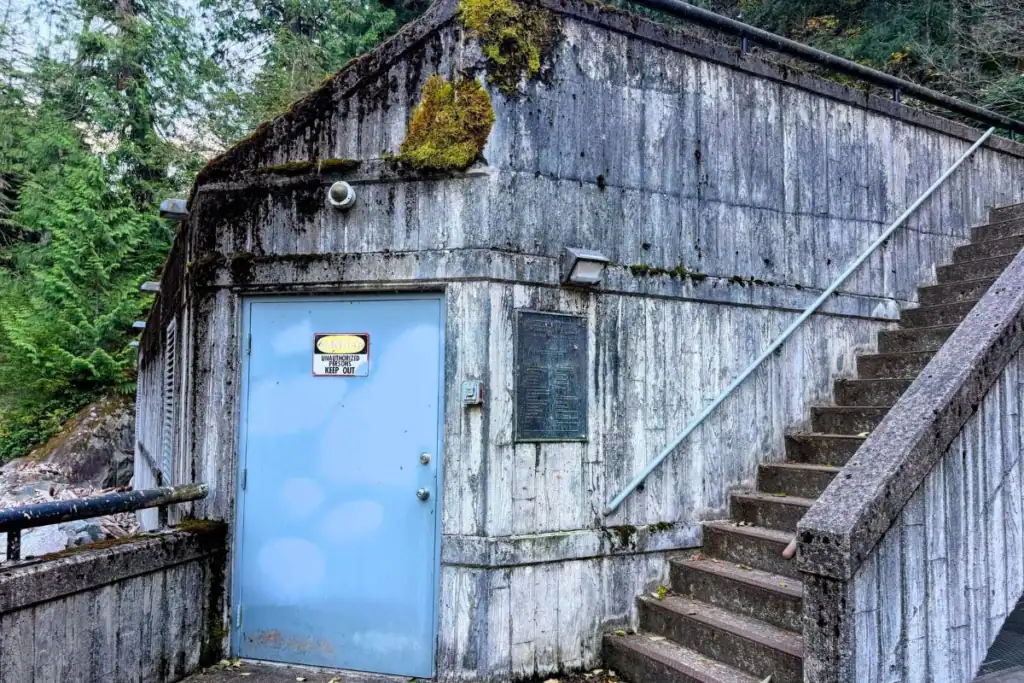
If you’d rather skip the longer forest walk, a separate parking area near Weeks Falls offers designated accessible parking and a very short paved approach to the waterfall viewing area.
Want to explore Weeks Falls? Read my complete Weeks Falls Interpretive Trail Guide for parking directions, trail details, accessibility information, and more photos from my visit.
Hiking The Olallie Trail to Hall Point
If you’re after mountain views instead of waterfalls, the Olallie Trail gets a bit more interesting… and a little tougher.
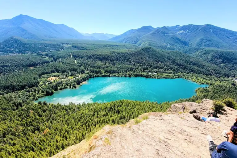
The trail winds up through the forested hills above the Snoqualmie Valley, with a few chances to catch your breath at viewpoints like Hall Point and Olallie Knob.
It’s not like the mild riverside strolls elsewhere in the park… here, you’ll be climbing steadily, and the terrain can get a bit rough and rocky in places.
This hike is best for folks who enjoy a longer workout, dynamic trail pacing, and want those big mountain and valley views as a reward. If you’re used to easier trails, you might find yourself questioning your life choices halfway up the elevation gain… but the scenery at the top usually makes up for it.
Palouse to Cascades State Park Trail Connection
One thing I like about Olallie State Park is how it connects to the Palouse to Cascades State Park Trail… a historic rail trail that runs across Washington.
This wide, gently sloping path follows an old railroad corridor, so it’s a whole different experience from the steeper hikes in the park.
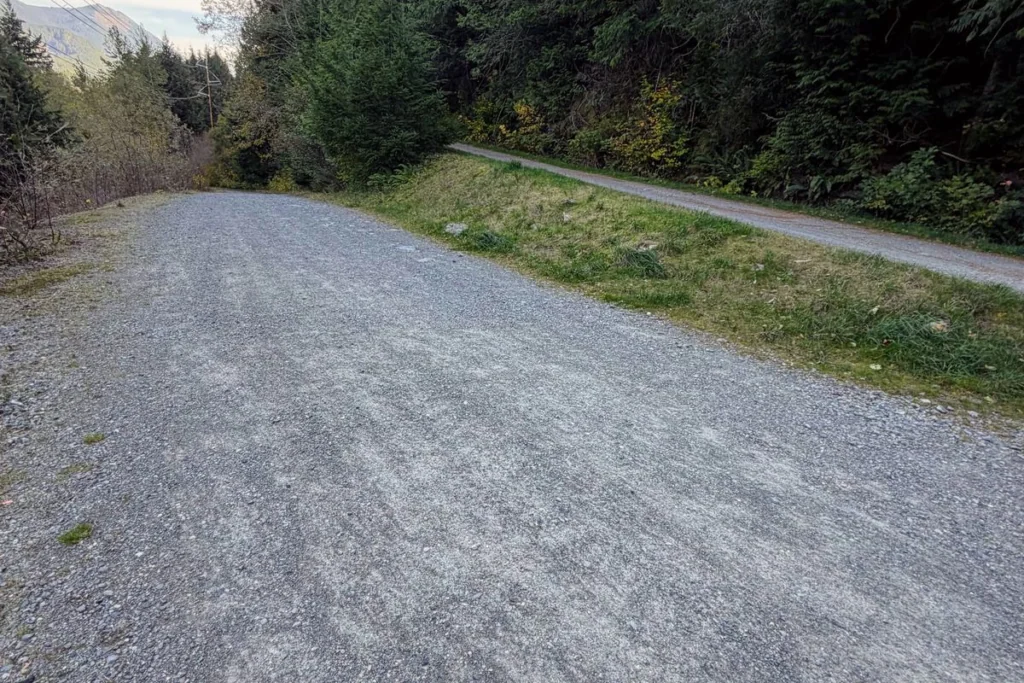
You’ll see walkers, cyclists, and the occasional history buff out looking for old railroad history and hidden artifacts in the woods.
The trail winds through the trees and connects with some fascinating, abandoned railway structures… there are a few impressive railroad trestles if you keep going far enough down the path.
You don’t have to commit to a marathon to enjoy it, either. Even a short stroll gives you a different look at the beautiful Snoqualmie Valley views… and sometimes that’s all you really need.
Twin Peaks Filming Locations at Olallie State Park
Here’s something I didn’t know when I visited Olallie State Park… parts of the park were used as filming locations for the cult-classic television series Twin Peaks and its later productions, including the 2017 revival!
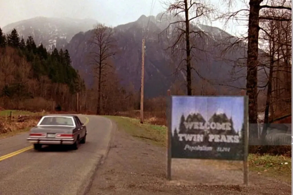
I remember all the hype surrounding Twin Peaks when it first aired in the early 1990s. I watched some of it, although I never became a devoted fan.
That said, I am still fascinated with film locations because to me, it makes it a historic site… and I love historic sites.
It wasn’t until I got home and started researching the park that I discovered I’d walked right through several recognizable filming locations.
The small ranger’s house near the river appeared as the Deer Meadow Sheriff’s Department in the 1992 film Twin Peaks: Fire Walk with Me.
The nearby riverbank was also used for scenes in the Twin Peaks story.
Remember that enormous fallen tree along the Weeks Falls Trail?
It turns out it was a famous giant spruce featured in the 2017 series Twin Peaks: The Return, during a scene involving Steven and Gersten.
The tree stood for hundreds of years before a powerful winter storm brought it down in January 2024.
Its massive fallen trunk and broken remains are still an impressive sight along the trail.
I found photographs and videos showing what the tree looked like before it fell, and it was fascinating to recognize the very spot where I’d stopped to admire it.
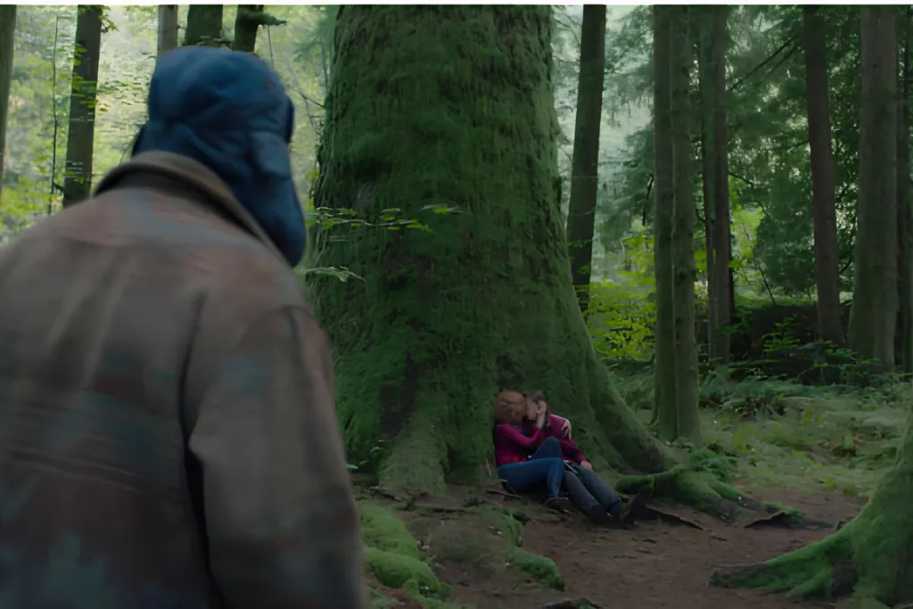
Even if you’ve never watched Twin Peaks, this little stretch of forest is worth exploring for its natural beauty and history. But for fans of the show, it’s an opportunity to visit some recognizable filming locations.
My Tip: For interesting photographs, production details, and a closer look at the famous spruce before and after it fell, check out the incredibly detailed Twin Peaks Blog filming location guides.
Things To Do At Olallie State Park (Beyond Hiking)
Enjoy a Picnic Along the South Fork Snoqualmie River
The South Fork Picnic Area is a lovely place to slow down and enjoy the forest without committing to a long hike.
You’ll find picnic tables, grassy areas, and access to the river. It’s a great spot to enjoy lunch before or after exploring Weeks Falls.
SPORT CLIMBING AT EXIT 38: DECEPTION CRAGS & FAR SIDE
Olallie State Park is a premier sport climbing destination along the Interstate 90 corridor, attracting climbers from across the Seattle area.
The forest hides dramatic metamorphic rock cliffs with hundreds of bolted routes for climbers of all skill levels.
The park’s climbing areas are split into a few main sections.
- Deception Crags: Just off the Homestead Valley side, this area has popular, steep walls like Substation Cliffs and Write-Off Rock. Trails wind right around tall rock faces below the old, curving railroad bridges, making the layout unique.
- Far Side Crags: On the north side of the highway near the Dirty Harry’s Peak trailhead, these walls get plenty of sun thanks to their southern exposure.
- Spots like Neverland and Interstate Park have excellent multi-pitch routes and crags hidden deeper in the forest.
Even if scaling the vertical walls isn’t your personal thing, the massive, towering rock formations along the mountain corridors are worth stopping to admire from the walking paths.
Important Seasonal Tip: Some cliffs close from mid-May to mid-August to protect nesting Peregrine Falcons, since this area is important for wildlife. Check live trail alerts or local climbing updates before planning a summer trip.
Photograph the Forest and Waterfalls
Olallie State Park is a great place for nature photography, especially when autumn leaves cover the dirt paths. I love taking pictures of mossy logs, tall old trees, rushing rivers, rocky cliffs, and forest waterfalls.
Here are a few simple tips I learned for capturing the best shots around the park:
The Simple Phone Trick: If you’re using a smartphone, turn on Live Photo before taking a picture of the waterfall. After you take the shot, open it in your phone’s gallery, swipe up, and choose Long Exposure. This will blur the rushing water into a smooth, beautiful stream..
Embrace Overcast Days: Bright, sunny afternoons can make forest photography tough because the sunlight creates harsh shadows and glare on the water. Rainy, foggy, or overcast days give you soft, even light that makes the greens of moss and ferns stand out.
Use Nature to Frame Your Shots: The woods here are thick and a bit wild. To make your photos simpler, let the landscape guide the viewer’s eye. You can set up your camera behind a big fallen log, or stand in the middle of a wooden footbridge to create a line that leads to the trees or river.
Capture Smooth Waterfall Motion: To get that classic silky look at Twin Falls or Weeks Falls, slow down your camera’s shutter speed. If you’re using a regular camera, place it on a steady rock or tripod and set the shutter speed to about 1 or 2 seconds.
When Is the Best Time to Visit Olallie State Park?
Olallie State Park is open for day use all year. However, the mountain weather along the Snoqualmie River means the trails can look very different depending on the month.
Spring (March to May)
Spring is the best time to see the waterfalls. When the snow melts in the mountains, the South Fork Snoqualmie River rises, and both Twin Falls and Weeks Falls become fast and loud. The surrounding forest turns a deep, bright green.
- What to expect: Trails are usually wet, slick, and muddy. Bring sturdy shoes with good grip to safely walk over wet roots and stone steps.
Summer (June to August)
Summer brings long, beautiful days and the most comfortable weather for hiking, exploring the old rail trail connections, or sitting down for a picnic by the river.
- What to expect: This is the busiest time of year. The main Twin Falls parking lot fills up early on weekends, and the trails can get crowded. For a quieter visit, come early on a weekday morning or go to the less crowded Weeks Falls area.
Fall (September to November)
Autumn is my absolute favorite time to explore Olallie. The summer crowds drop off significantly, the air gets crisp, and the big-leaf maples turn vibrant shades of yellow and orange against the dark green evergreens.
- What to expect: It is a perfect, quiet window for nature photography and peaceful solitude. Just keep an eye out for early winter rainstorms that can start rolling through late in the season.
Winter (December to February)
In winter, the park feels quiet and beautiful. Frost covers the mossy logs, and sometimes you can see a light layer of snow along the riverbank.
- What to expect: Mountain storms can raise water levels, knock down trees, and wash out trails. Some access roads or parking lots may freeze, hiding black ice.
Be sure to check the official Washington State Parks website for live trail alerts before you go, especially if there was a recent wind or rainstorm.
Tips for Visiting Olallie State Park
- Know which entrance you want ahead of time. Because Olallie is split across different highway exits, you can’t drive internally from one side of the park to the other. Decide if you want to explore the classic Twin Falls Main Trailhead via Exit 34, or if you prefer the quieter woods, rock climbing walls, and easy boardwalks at Weeks Falls via Exit 38.
- Bring your Washington Discover Pass. A valid pass is strictly required for parking anywhere inside Olallie State Park limits. Make sure to display the physical pass clearly on your vehicle’s front dashboard or rearview mirror. If you don’t own an annual pass, you can purchase a $10 day pass using the automated pay stations located at the main developed trailheads.
- Keep your dogs securely leashed. Olallie is a wonderfully dog-friendly park, and it’s a great place to explore with a pup like Bud! However, to protect the delicate local wildlife, nesting birds, and other hikers on narrow trail switchbacks, your pets must remain on a standard leash at all times.
- Wear shoes with good, rugged traction. Even if you plan on sticking to the shorter, flatter forest interpretive trails, the ground here is damp and uneven. The paths are full of slick tree roots, smooth river rocks, and muddy stone steps. Wearing sturdy hiking shoes or sneakers with a deep grip will keep your ankles and joints safe.
- Don’t rely entirely on cell phone GPS. The deep river canyon and dense old-growth forest canopy create notorious dead zones for cellular service along the I-90 corridor. Your phone’s navigation app will likely freeze up or drop its signal once you pull off the highway. To avoid navigation panic, download the official Olallie State Park map for offline use via apps like AllTrails or Gaia GPS before you leave the house.
- Be incredibly cautious around the riverbank. The South Fork Snoqualmie River is entirely fed by mountain snowmelt. The water is freezing cold year-round, and the currents move fast, especially during the peak spring flow or after heavy autumn rainstorms. Stay securely on the designated wooden viewing platforms and keep a safe distance from slick, mossy rocks near the water’s edge.
- Check live Washington State Park trail alerts. Severe Pacific Northwest winter storms, high winds, and heavy rain can instantly cause fallen logs, broken footbridge handrails, or sudden trail washouts across the park’s 2,300 acres. Always check the official state park website for active closures before heading out.
- Give yourself permission to take your time. Olallie has so many distinct separate areas, hidden historic spots, and quiet sensory pockets to discover. Instead of rushing to see everything in a single afternoon, pick just one zone to explore at a slow, comfortable pace. You can always save the rest for a return trip!
Is Olallie State Park Worth Visiting?
Absolutely. It is an incredible place to spend a day if you enjoy forest waterfalls, deep wilderness history, and quiet river landscapes along the I-90 corridor.
Twin Falls is the main draw for most people, and it completely deserves its popularity. It is a classic Pacific Northwest hike that leaves you feeling fully immersed in the dense green woods.
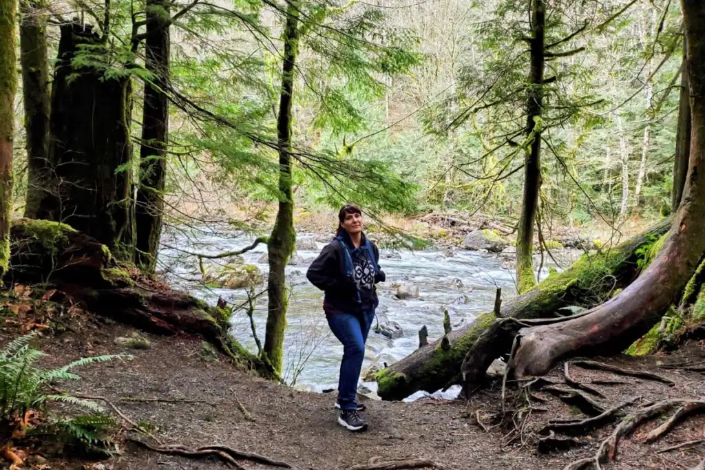
But I think the South Fork Picnic Area and the Weeks Falls Interpretive Trail deserve just as much attention.
They are wonderful options if you want a shorter forest stroll, a peaceful spot to sit by the water, or a chance to explore a less-visited pocket of the park away from the main weekend crowds.
Don’t expect Olallie to look like a traditional, centralized state park built around a single campground or lake.
Instead, it operates like a large, connected network of hiking, biking, and climbing paths that weaves together hidden gorges, moss-covered trees, and rushing river valleys.
While it doesn’t have a standard park layout, that’s exactly what makes it so fun to explore.
You can visit for a high-intensity mountain climb, a leisurely afternoon photographing the river pools, or a slow walk to find the local history hidden among the evergreens.
Sometimes, the absolute best discoveries happen when you give yourself permission to venture beyond the main trailhead everyone else is rushing toward.
Want to read about my own experience finding this side of the park? Check out Beyond Twin Falls: A Fall Adventure at Olallie State Park, where I share the wrong turns, unexpected discoveries, and beautiful October afternoon that led me to Weeks Falls.